New to orienteering?
Orienteering is a family of sports where competitors use a map and compass to navigate around a course in diverse and usually unfamiliar terrain. Along the way are checkpoints at specific locations, known as “controls”. Deciding which route to take between controls is what orienteering is all about… it’s part of the fun!
Orienteering originated in Sweden at the end of the nineteenth century, as a training exercise in land navigation for military officers, and has since developed in many variations. Among these, the oldest and the most popular is foot orienteering.
Foot orienteering is split into two general disciplines:
- Sprint orienteering (usually urban, ~15 minute winning time)
- Classic orienteering (parks and forests, our local events usually have a winning time of 45-60 minutes)
Other types of orienteering are:
- Mountain bike orienteering
- Ski orienteering
- Rogaining
- Adventure racing
What to expect at an event
Before you arrive
Pre-entry
Orienteering Wellington prefers people to register before arriving at the event. This allows us to get everyone running as quickly as possible! On the events page, you will see a link to “Entries” where you can register your interest and pay for your entry before you arrive.
During the entry process, you will need to select the course you want to run. Generally, the courses are colour-coded based on difficulty:
- White: Easiest, following linear features such as paths and fences
- Yellow: A little harder, but the controls will mostly be visible from the path
- Orange: Requires some skill with a map including identifying contour shapes, but controls should be visible if you are in the right area.
- Red: Hard navigation requiring map and compass skills, control sites will be difficult to find.
For larger events, you may be pre-allocated a start time, so watch out for event information emails!

What to bring
- A compass, if you have one
- A change of clothes - expect to get wet and muddy!
- Grippy shoes
- A SportIdent card, if you have one
Registration
When you arrive at an event, the first place to go is Registration. Registration is where you will pick up your SportIdent card (if you don’t have your own) and get help on what to do next.
The SportIdent card is your personal dibber to use as you pass each control. If you’re new, you can hire these from us. We can also loan you a compass.
If you have pre-entered and have your own SportIdent (SI) card then you don’t need to go to Registration - just go straight to the start.
Starts
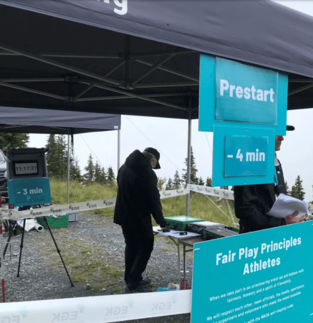
Event organisers will help you through the start procedure. Generally the start will be organised into “lanes” and “blocks”. The lanes, marked with the course name, are to help organise competitors into the different courses.
Within each lane, multiple blocks may be used to separate competitors so you can’t follow the person in front of you… or be followed by the person behind!


The map
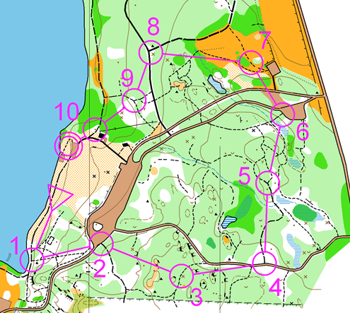
Orienteering relies on understanding how to use a map and compass to navigate around a series of controls.
Orienteering New Zealand has some good resources to get you started with reading and understanding an orienteering map.
Controls
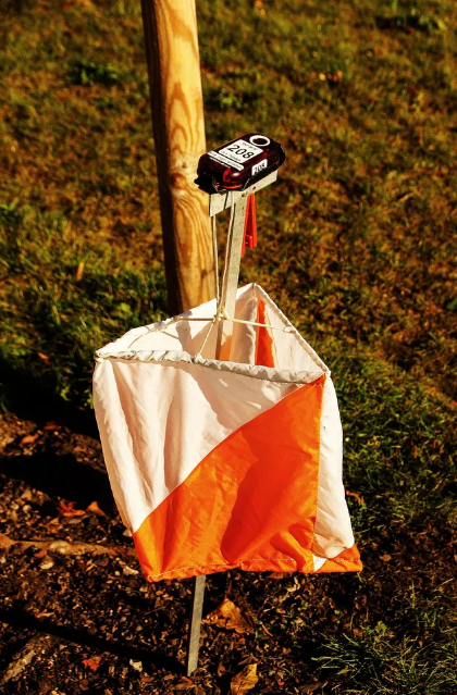
At the centre of each circle on the map is a Control. These have an orange and white flag as depicted in the image opposite. The control will also have a number on it, so you can check you’re at the right one!
Each control also has a box on top. When you arrive at the control, put your SI card into the hole on top of the box until your SI card flashes or beeps. This shows that your time at that control has been recorded.
Newer versions of the SI card now work “contactless” so they may beep or flash without you having to put the SI card into the hole. Once it beeps or flashes, you’re good to go.


Finish & Download
Before you leave the event - whether you finished your course or not - you must go to the Download tent (usually situated at the finish location on the map). This is for everyone’s safety; if we don’t know you’ve finished, we will go out searching for you!
At Download, we’ll retrieve the results from your SI card - all you have to do is put your SI card into a box similar to the ones on the controls. You’ll get a printout of how long it took you to navigate between each control and around the course.
Once you’ve downloaded, enjoy talking to others about how long it took them to navigate between the controls and what routes they took!
After the event
After the event, the official results will be posted on the Events page of the Orienteering Wellington’s website.
We often also upload the map to Routegadget. There, you can draw your route (or upload the trace from your GPS watch) and compare your navigation and speed with your competitors.

Other resources
You can find some other great resources at the websites of neighbouring clubs, as well as from the national and international orienteering bodies.
Local
- Orienteering Hutt Valley
- Red Kiwi Orienteering Club (Horowhenua/Manawatū/Whanganui)